
上圖是Trango tower,海拔6286M,這個TOWER以近乎垂直最高的岩壁著名,也是世界最難爬的山之一
第四天及第五天天氣變化,看到了雲彩的變化;第四天也是踏上長63公里baltoro冰河的第一天
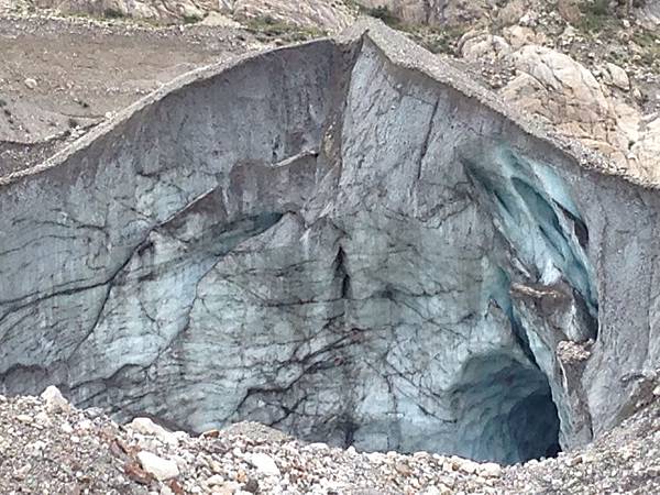
一上冰河就可見這個藍洞
今天之後的山除了peak外還有很多稱為tower的山型,還有稱為教堂的山型;當然還有大大小小的冰河就掛在每一個山坳處
雖然上了冰河日照及風砂仍然非常強,要注意補水

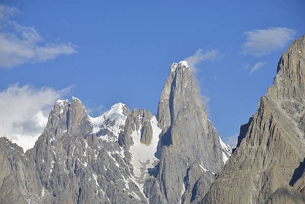
上下圖也是TOWER,但不知是那個TOWER
在路的左手邊,那一帶的山群稱為TOWER山群,都長這個樣子,像一個塔,直接上去
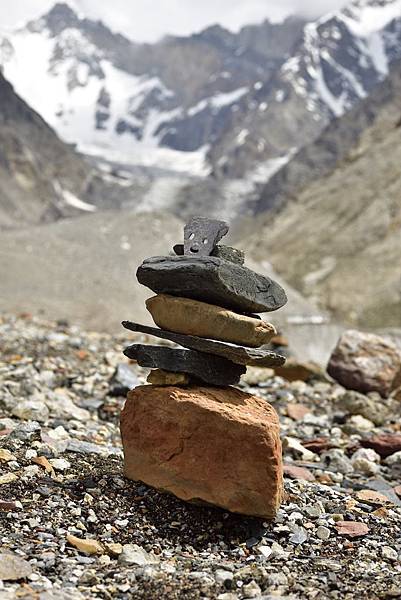
還有可愛的路標,及零零散散的冰塔林


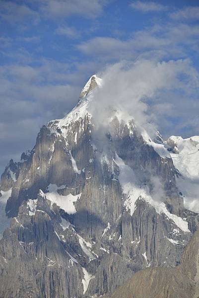
上圖是paju peak,海拔6610m,下圖己忘記是那個PEAK


緊接著在TOWER山群後面的是教堂山群,隔一條冰河,這一區的山以大量三角形造形著稱,還是非常有型
如果看地圖則統稱MAIN CATHEDRAL,最高峰6024M

英文版行程如下
Day 07: Paiju to khobuchi. 5/6 hours. Altitude: 4000m, Condition: hard stony and icy.
We set out from paiju and start trek with a gradual climb up Baltoro Glacier on the southern edge. After about one hour the path divides at the snout of Baltoro glacier where the left branch goes to the base camp of Trango Tower, Shipton tower. Continue to the path climbing up on to the glacier that stretches up the valley further one to two hours steady climb up and down on a long diagonal to the right side you will rich in Liligo camp where will be lunch break after lunch walk for about two hours to the khubochi campsite.
Day 08:Khubochi to Urdukas . 3/4 hours. 4130m, Condition: hard stony and icy.
Today morning we leave khubochi camp and walk mostly and slowly up along the crest of lateral moraine towards Urdukas. This camp has superb views across the Baltoro Glacier to the Trango peaks, having view of Paiu Peak, Chorichi, Uli Biaho, Trango Tower and so on and is our last 'green grass' campsite. Meals: Breakfast, Lunch, Dinner Accommodation: Camping.
Day 09: Urdukas to Goro. 6/7 hours. Altitude : 4500m Condition: stony. Rise early and view the beautiful sun light on the all rocky towers of the Karakorm it is a good opportunity to get pictuers .After breakfast A long walk on the icy Baltoro Glacier, Traveling on the glacier it is almost an all day walk over the boulder-strewn glacier to the campsite at Goro. Traverse the Yermanandu Glacier which flows down from Masherbrum & joins the Baltoro. Masherbrum is visible on the right side of the glacier, and Mustagh Tower on the left, Broad Peak, Gasherbrum IV, Mattra peak,and can be seen directly ahead, as they catch the evening sunlight and Masherbrum can sen right site form the Goro camp. Meals: Breakfast, Lunch, Dinner Accommodation: Camping.
第五天是輕鬆的一天,只走三個小時,這個營地也是最後一個在土地上的營地,之後二個營地都睡在冰河上
因為今天輕鬆,中午前就到達,加上充足的水源,炎熱的天氣 大家就趁這個時侯洗頭!
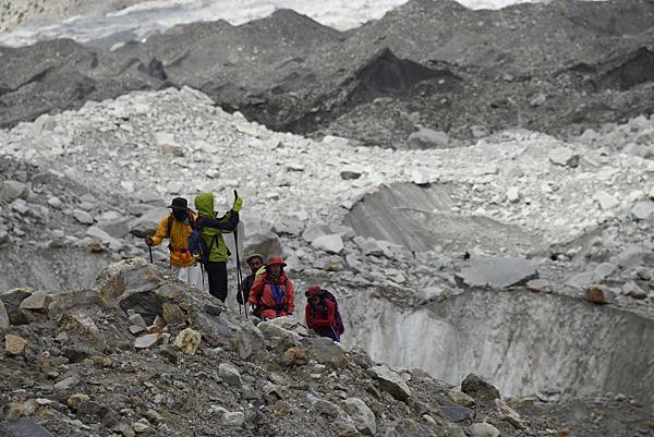
愈往上走,橫渡冰河的次數愈多,冰河也愈來愈乾淨

以下是中文行程
7/22 Paiju to Khubuche 16km Depart 0605-1350 Lunch 10:10-11:05
7/23 Khubuche to Urduka 洗頭營地 6km Depart 625-10:45
7/24 Urdukas to Goro Depart 620-13:20 Baltoro Mundoo Lungka glacier Lunch 10:40-11:30
第六天,終於來到goro two營地地,在這個營地,G4, BROAD PEAK, MASHERBRUM都清晰可見,還可看到
台灣稱為鉅齒連峰的山群,巴基斯坦那邊稱為tooth,, 只不過black tooth海拔拔6719M
DEVIL TOOTH PEAK 海拔 6310M,都比台灣高的多!

其實稱為toooth還蠻像的,喀爾崑崙很多山就突然一個齒就上去了!

海拔6700M聽起來很高,山型也很特殊,但現在的焦點是海拔沒有7800M很難吸引我們的目光,
就從最低的MASHBRUM說起,海拔7806M

再來是G4,7925M,藏在G4後面露出一點頭的G2,八千米級的老么, 8035M


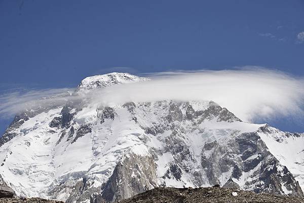
還有正前方的Broad peak, 8051M
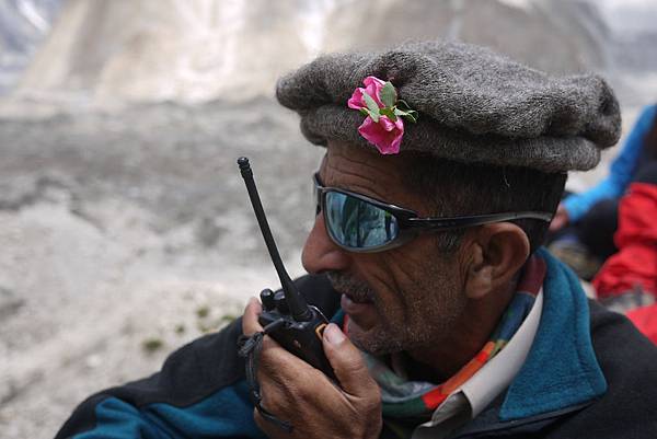
上圖,我們主要的guide, ali,我們這個team總共有三個guide,其中一個
下圖,urdukas camp

明天就要往響往己久的營地,Concordia camp.

下一章,k2bchttps://betapanel.pixnet.cc/#/edit-article/460035552


 留言列表
留言列表


