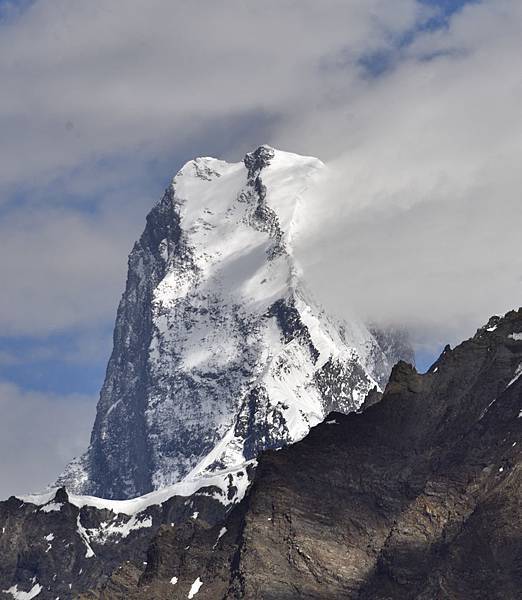
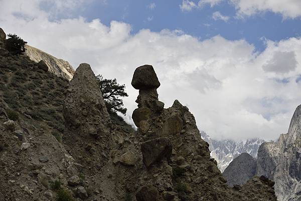
上圖,Muztang tower,海拔7283M,山形是塔形,十分特殊,位於巴基斯坦和中國邊界
我想中國那側對於喀爾崑崙可能因自然環境限制,觀光開發不是很積極,這一區算是中國少數祕境
今天的重頭戲就是翻過啞口,由於gondogoro La海拔高達5625M,Ali camp 4965M,除了當天要爬升700M(而且是陡升)
還要在太陽剛日出前翻越,以避免雪崩
本以為上山之後就結束了,沒想到下山一樣很陡,下降的營地海拔4695M,大約下降1000M
今日行程與K2BC並列此次徒歩的二大重頭戲,K2BC往返只是單純的路途遠,對体力是項考驗,但並沒有其它要注意的
但今晚的行程一個是要半夜爬,一個是海拔高要注意高山反應,另一個是很陡,最後一個是怕天氣變化
因為高危險性所以只能天氣好的時侯翻啞口,到達時大家都會慶祝,最難的一關己過,再來只要下山回家


gondogoro la 因為夠高,是很好的觀景平台,不過我們上去的時侯天空有雲,沒看到一直沒露面的G1,hidden peak,成為此行唯一的遺憾


上下圖,半夜翻啞口,你可看見有多陡,但均架有繩子,所以並不需要冰瓜及釘鞋

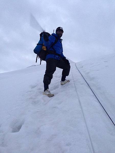
上圖,並不誇張,就這麼陡,上圖中的GUIDE可是登頂過三座八千米的山;
要下山時,同樣要那麼陡的下山,如下圖,今天的營地就在下方的山谷

下山的時侯注意上方的落石,早我們二天下山的那一大票人就有三個porter被落石擊中
英文版行程如下
Day 14: Ali camp to Cross G La Khuspang. 9 hours. Altitude: 5700m, Condition: hard icy.
Today our trek start as early as 2 or 3 o'clock in the morning to cross the Ghondogoro la to reach Khuspang.we sould get up 1o'clock at night The basic theme behind the early walk to reach the top of the Ghondogoro Pass 5600 meters is that in the morning snow will be soft and we will not get tired quickly as the sun is not strong, but as sun get strong snow get soft snow going to be melt and bring water and stones, also the chance of ice falls or avalanches and second is when we get on to top early we can find the son light most spectacular view on earth on the top of K.2, Broad peak, GIGII , Muztagh Tower and from Hushe side you will find Laila peak, Ninchi peak and other a lot of more peaks and we can get good photography. Also this day is one of the toughest and most challenging days of the trek, and although it is a long and tiring day, Muztagh Tower and from Hushe side you will find Laila peak, pastoro peak and a lot of more.
Meals: Breakfast, Lunch, Dinner.. Accommodation: Camping.
Day 15: Khuspang to Saischo. 5/6 hours. Altitude: 3450m Condition: hard stony and icy, After an easy walk we will enter in to the moving boulders and ice glacier, finally crossing the glacier up to the camping site to reach Dalsangpa, meaning 'field of flowers'. It is a beautiful campsite at about 4,150 meters, set between two lakes, with Masherbrum Mountain and the white glacier cascading down from Masherbrum Pass reflected in the still water.Resume trek along the path,on the left side of the lateral moraine, crossing several side streams. The next hour is an unpleasant scramble along the stony, sliding glacier edge, with huge boulders poised above.Continue trek along the path goes down hill to the summer settlement called Saicho, a large shepherds settlement.This is the traditional camp among the forest of juniper, cedar and willow trees with giant bushes of wild roses and a good water supply. Meals: Breakfast, Lunch, Dinner. Accommodation: Camping.
Day 16: Saischo to Hushe/skardu. 7/8 hours. Altitude: 3450m, Condition: Normal. Early morning start walk after breakfast towards Hushe on an easy path. Upon arrival camp near the fields in Hushe, with the huge peak of Masherbrum dominating the view to the north. At an altitude of over 3000 metres, Hushe is the highest village in the area and is the first habitation we will see when we reach the Hushe Valley and finely after a long and hard trek we reach in Hushe village. Meals: Breakfast, Lunch, Dinner. Accommodation: Hotel Indus hotel Skardu, snow land palace Hotel Skardu.
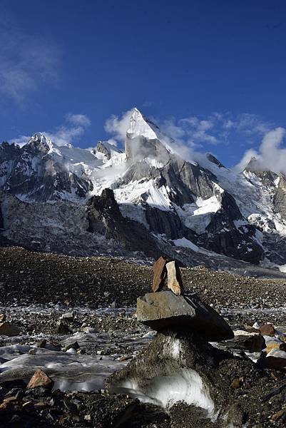
上圖,下山後最有個性的山, Laila peak及路標,海拔6096M,說到路標不得不提巴基斯坦人幽默的一面,
下面是中文實際行程
7/29 18km Ali camp to G pass Depart 00:00 Gondogoro la 0500 Arrival Khuspang 0955 百花營地
7/30 Khuspang to Saicho 披薩營地 17km Depart 0640-14:20 Lunch 1125-1210
7/31 Saicho-Hushe 0605-0855 坐車回Skardu


下山之後的營地每個都很漂亮,都有漂亮的花草及平地,當然可能跟瑞士登山會有關係
路上的銅牌標示2017年年初瑞士登山協會和當地PORTER才剛整理完Gondogoro la到可搭車村莊的道路
因為翻過啞口的人本來就不多,所以這條路就更加的原始

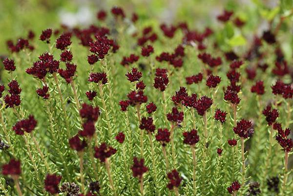
下到溪谷之後沒多久就可見到許久沒有的草地及花




上圖,這邊很能体會喀爾崑崙的意函"黑色山体",隨便看,山形崢嶸,冰川還是隨處掛
當然下山之後並非一帆風順,基本上是沿著冰河走,然後到草地,天氣愈來愈熱,接著看到有牧民放牧的牛羊,不過山還是十分有個性
最危險的還要要赤腳渡河,如下圖



第三天只要步行三個小時,填完問券之後即可出山坐車,沿路仍屬十分有個性的山,
下圖是村莊所見的最後一個雪山,海拔7806M的Masherbrum 另一面,我們之前徒歩的Baltoro河就在她的另一面


上圖,攝於最後一個營地Saicho,從這裡可見k6,k7
下圖,攝於Hushey村的小女孩,然後坐車回又熱又塵土飛揚的Skardu.


 留言列表
留言列表


